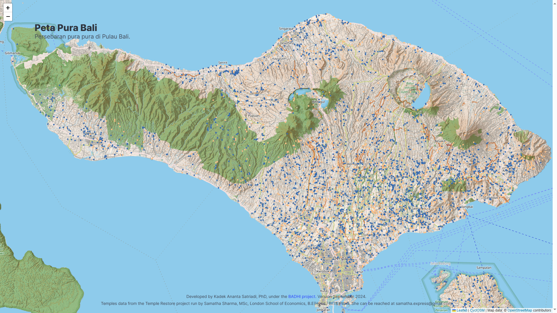
We created an interactive map depicting the locations of documented temples across Bali. This is a starting point towards a better understanding of the state of the Balinese temples.
Go to the map.
Participatory Digital Archiving of Balinese Temples
Creating digital snapshots of Balinese Temples for future generations
Bali is susceptible to natural disasters such as earthquakes, landslides, and volcanic eruptions. Bali has experienced 21 earthquakes of magnitude 6+ since 1900 and 31 earthquakes of magnitude 4+ in the last three years alone. The island has two active volcanoes, one of which had a major eruption in 1963. Throughout history, temples in Bali have been repeatedly affected or altered by these events, and renovations also often lead to changes in their structures. For instance, the 6.5 magnitude earthquake in 1976 was reported to have destroyed thousands of temples. Despite the vulnerability, archival efforts to document the physical features of temples are virtually non-existent. Through this Whyte Fund project and the future platform, the Balinese community can maintain records of their temples, preserving their cultural values and identity for generations to come. The records can also serve as a reference for future restorations.

Fundings
The Whyte Fund Monash University (2024-2025). Pilot study and initial platform design.